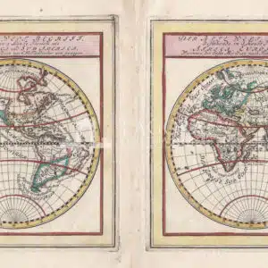
Antica mappa dei due emisferi in miniatura di G. Bodenehr (1664-1758), pubblicata ad Augsburg nel 1704 circa. Ciascuno emisfero è rappresentato in una cornice incisa con il titolo in tedesco. Autore: Gabriel I Bodeneher (1673 - 1765) Anno: 1704 Misure: battuta cm 15 x 13 (in 6 x 5 1/4 ) Tecnica: Incisione su rame acquerellata a mano
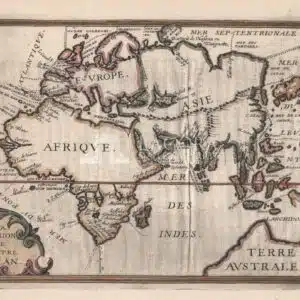
Map of the eastern hemisphere identifies each of the oceans and shows the divisions between them. The Atlantic Ocean is named Mer du Ponant ou Atlantique and the Pacific is Mer du Levant. There are place names of capes and rivers along the coastlines, and interior detail is limited to a few mountain ranges, lakes and rivers. A large Terre…
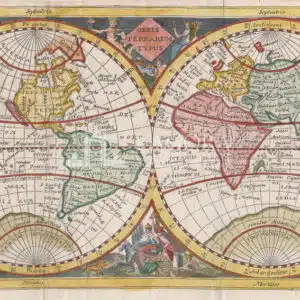
Una mappa del mondo a doppio emisfero colorata a mano intitolata "Orbis Terrarum Typus” di Jan Jansson van Waesberge, edizione successiva di una carta di Philipp Clüver pubblicata in Germania a Leida nel 1624, poco dopo la sua morte nel 1622, nel suo atlante "Introductio in Universam Geographiam". La mappa è impreziosita da sei scene allegoriche, tra cui Nettuno, raffigurato…
Globe, artisanal reproduction on cotton paper Author: Artisan Year: New Size: L 76 x H 56 cm / L 29.92 x H 22.05 in Technique: Print and watercolour by hand on cotton paper