SKU (sam-062) Romani Imperii qua oriens est Descriptio Geographica-1 Categories , , Tags , , , ,

Patriarchatus Romanus – Roman Empire

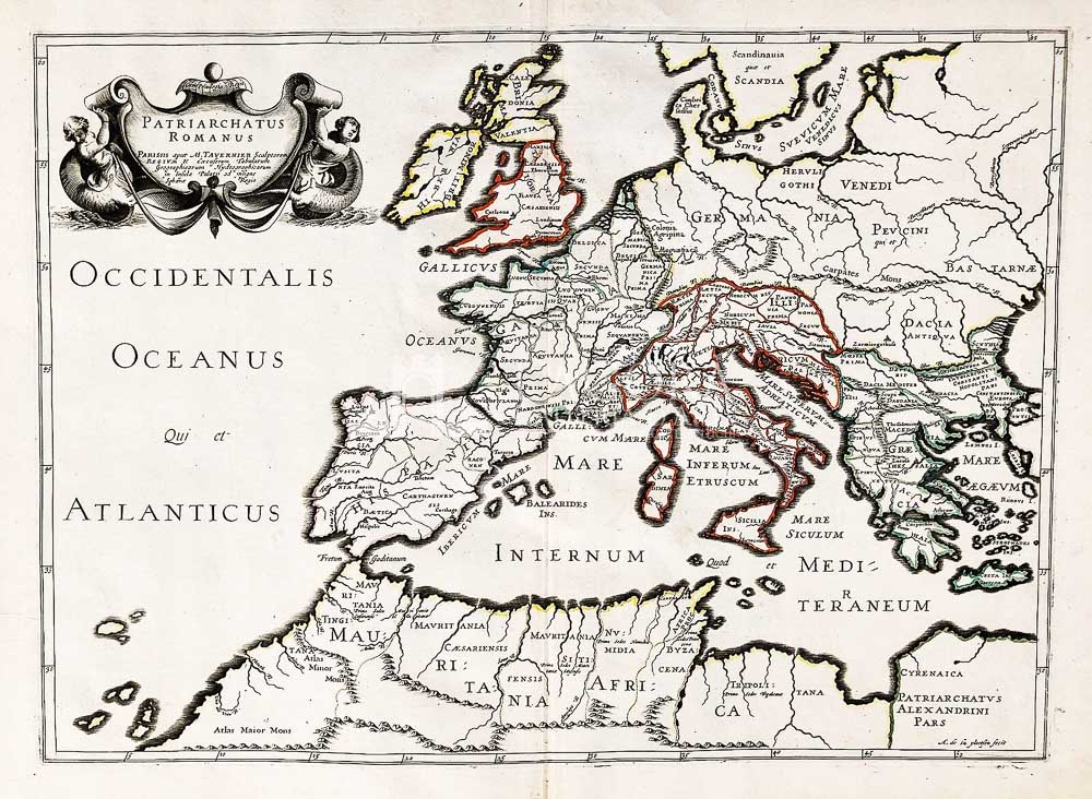
Rara mappa antica di grande formato di Nicolas Sanson, incisione su rame con acquerellatura coeva tratta dall’ Atlante “Cartes Generales de toutes les Parties du Monde”, considerato il primo grande atlante mondiale francese.

Author: Nicolas Sanson (1600-1667) / Melchior Tavernier (1594-1665)
Year: 1650 ca
Size: 52 x 37 cm circa (battuta)
Technique: Incisione su rame, colorata a mano

This item is a one of a kind. Contact us for more information

Contact us

Shipping

Shipping times take between 5 and 7 working days. If the product is out of stock, it will take between 20 and 30 days.
Free shipping for purchases of at least €300
Read more

Right of withdrawal

The private buyer who buys a good online or at a distance can return it and get a refund of the amount paid, exercising the right of withdrawal within fourteen days of delivery and/or receipt of the goods.
Read more

SKU (sam-062) Romani Imperii qua oriens est Descriptio Geographica-1 Categories , , Tags , , , ,

Art gallery in the heart of Taormina

THE HISTORY OF TAORMINA AND SICILY IN ART